New York’s Mohawk Valley was the scene of brutal fighting during the American Revolution. This obscure battle ended a particularly nasty raid that began with one settlement in ruins.
Click to expand photos
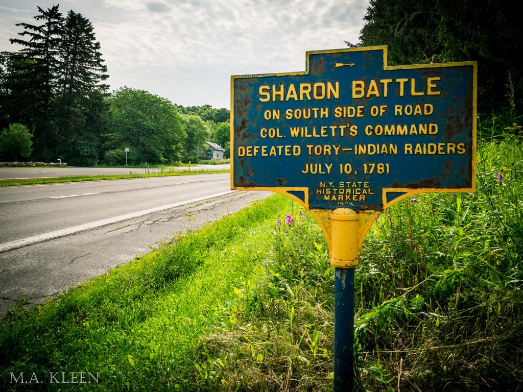
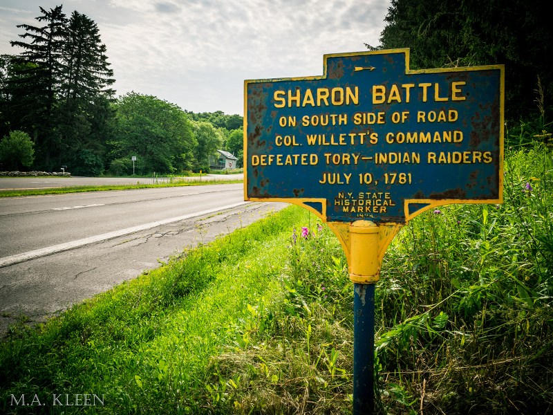
The Battle of Sharon Springs was fought on July 10, 1781 between British and American Indian raiders commanded by Capt. John Doxtader and American forces commanded by Col. Marinus Willet east of Sharon Springs in Schoharie County, New York during the American Revolutionary War. The battle was an American victory and many of the British loyalist forces and their Native American allies were killed and the rest scattered.
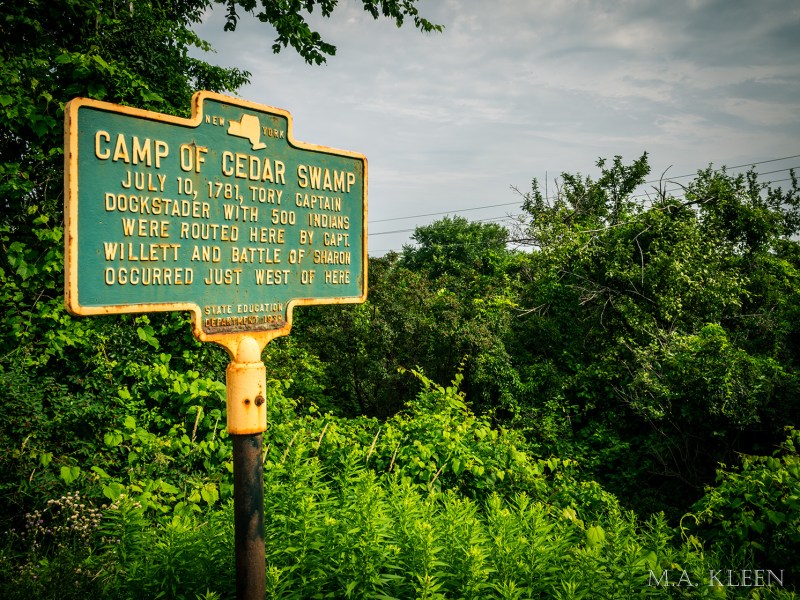
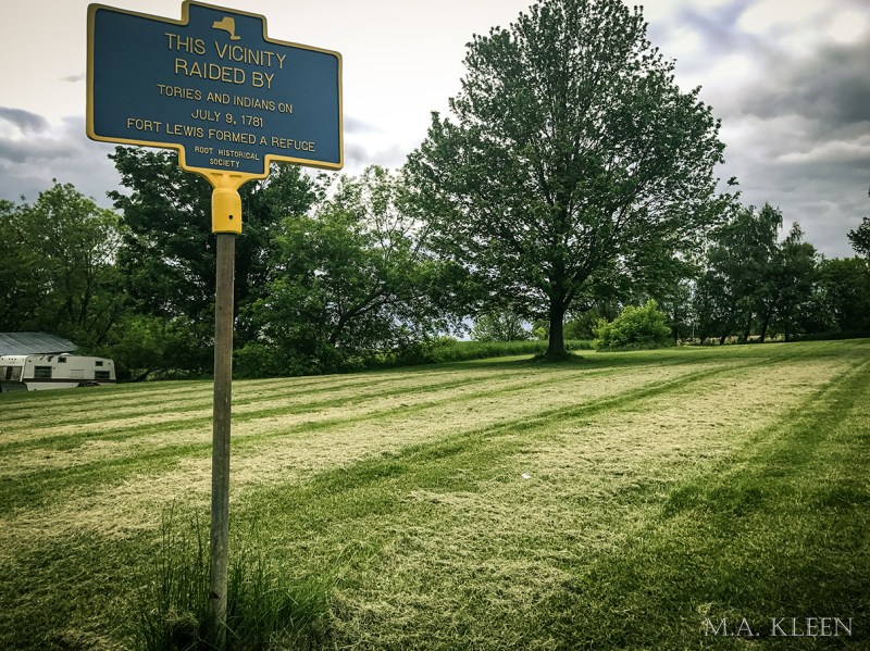
During the Revolutionary War, the Mohawk Valley in central New York was the scene of brutal fighting between patriots committed to American independence and loyalists committed to remaining under the British Crown. Many settlements and homesteads were raided and burned. On July 9, 1781, John Doxtader and approximately 300 Iroquois Indians and Loyalists attacked the frontier settlement of Currytown, killing a number of people and taking nine prisoner.
That night, they retired to a camp in Sharon Springs Swamp. The next day, Col. Marinus Willett sallied forth from Fort Plain and attacked their camp with a force of approximately 150 men. Despite being outnumbered 2-to-1, the Patriots used the dense terrain to their advantage and lured the raiders into a trap.
The Patriots lost five killed and nine wounded, and the Loyalists suffered approximately 40 casualties. Unfortunately, they were too late to rescue the nine prisoners from Currytown. When the battle began, the raiders beat them with tomahawks and dumped them in shallow graves. One man survived his injuries and crawled to safety.
Fought between Great Britain and her Thirteen American Colonies from 1775 to 1883, the Revolutionary War led to a Declaration of Independence and the formation of the United States of America in 1776. The Thirteen Colonies won their independence, at the cost of an estimated 158,000 British, American, French, German, Spanish, and American Indian lives. It was a dynamic and surprisingly international conflict.
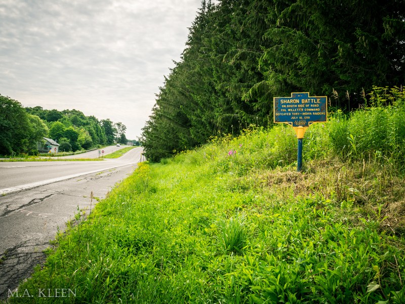
Today, U.S. Route 20 (a multi-lane highway) cuts through the swamps and forests of this region. Historical signs were erected in 1928 and 1939 marking the location of the battle and the British camp. A sign marking the Currytown Raid was erected more recently.
The Camp of Cedar Swamp sign is located at 42°46’53.7″N 74°35’34.4″W and the Sharon Battle sign is located at 42°46’47.8″N 74°35’17.7″W along U.S. Route 20, and the Currytown Raid sign is located north of there along NY-162 at 42°51’29.1″N 74°27’49.1″W. Roadside parking (not even a gravel pull off) is available for all three signs, so park at your own risk.


What are your thoughts?